
This document is an instruction manual for the Data Recorder GPS Expander V3, providing installation and operation guidance. The product features a 5Hz update rate, low power consumption, and battery backup, making it suitable for Eagle Tree's recording and wireless telemetry products. It is also compatible with various Eagle Tree recorders and dashboards.
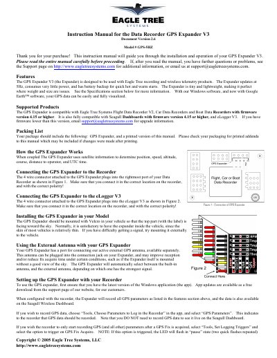
The Eagle Tree Systems GPS Expander V3 is a compact device designed to provide high-frequency (5Hz) GPS data updates for recording and wireless telemetry products. It features low power consumption, battery backup for quick cold and warm starts, and compatibility with various Eagle Tree recorders and Seagull Dashboards running firmware version 4.15 or higher.
| Update Frequency | 5Hz |
|---|---|
| Power Consumption | Very little power |
| Battery Backup Function | Quick hot and warm starts |
It is compatible with Flight Data Recorder V2, Car Data Recorders, Boat Data Recorders (firmware 4.15+), Seagull Dashboards (firmware 4.15+), and eLogger V3.
It should be mounted with Velcro so that the top part (with the label) faces toward the sky.
It will mark the Lat and Lon fields with an “*” beside the values to indicate a “stale” fix.