
Key facts
- Manuals
- 141
- Models
- 8
- Brands
- 30+
- Languages
- EN · ZH
- Last added
- 2026-10-03
Vehicle GPS models by brand
Featured Vehicle GPS manuals
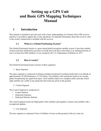
Garmin eTrex GPS Unit Setting Up and Basic Mapping Techniques Manual
The document provides step‑by‑step instructions for preparing a Garmin eTrex handheld GPS receiver for field use. It covers battery and microSD installation, data transfer, map loading, and basic configuration of system, unit, and time settings.
Key sections include initializing the receiver, loading OpenStreetMap‑compatible .img maps, setting up track logging (interval, wrap‑when‑full, and data‑card options), and detailed guidance on collecting points of interest, ways, and areas for mapping projects.
Covers: Introduction · Getting Started · Installing Batteries and a microSD Card · Transferring Data · Initializing the GPS Receiver · Loading a Map
Vehicle GPS Positioning System User Manual
This manual provides an overview of the vehicle GPS positioning system, its working principle and the standards it follows (JJG 1074‑2012). It includes guidance on installation, configuration, and safety considerations for technical personnel and end users.
The document also details testing procedures, speed range specifications, and maintenance requirements, ensuring the system meets the required performance and compliance criteria. This manual is written in Chinese.
Covers: Scope and Standards · Installation and Configuration · Operation Guidelines · Testing Procedures · Maintenance and Safety · Compliance and Documentation
Maction Technologies PaPaGO! 7 COPILOT Pocket PC User Guide
The PaPaGO! 7 COPILOT guide explains how to install, configure, and use the automotive navigation software on Pocket PC 2002/2003 devices. It covers basic operation, GPS setup, landmark management, and route planning.
The manual also includes safety notices for GPS use, licensing information, and contact details for Maction Technologies and its Taiwanese partner companies. This manual is written in Chinese.
Covers: Getting Started · GPS Satellite Settings · Landmark Management · Route Planning and Navigation · Safety and Usage Notices · Software Licensing and Copyright
Periskal Inland ECDIS Viewer User Manual with argonics TrackPilot
This manual provides step‑by‑step instructions for setting up the Periskal Inland ECDIS Viewer together with the argonics TrackPilot. It covers required hardware, network configuration, NMEA settings, and web‑service parameters needed for communication between the viewer and the TrackPilot.
The guide also details how to enter ship dimensions and antenna positions, create, edit, activate, and save waypoint routes, and reset waypoint numbering. Practical tips are included for ensuring accurate track conversion and reliable data logging.
Covers: Required hardware and options · Configuration of the Periskal Inland ECDIS Viewer and the TrackPilot · Ships measurements and antenna positions · Send routes as track to the TrackPilot · Create or edit your own routes · Waypoint activation and numbering
Latest Vehicle GPS manuals
Garmin eTrex GPS Unit Setting Up and Basic Mapping Techniques Manual
User Manual 12 pages · 3.8 MB · ENThis manual explains how to set up a Garmin eTrex GPS unit, install batteries and a microSD card, configure maps, and record track logs for OpenStreetMap.
Vehicle GPS Positioning System User Manual
User Manual 5 pages · 9 KB · ZHChinese user manual describing the operation, installation and testing of a vehicle GPS positioning system.
Maction Technologies PaPaGO! 7 COPILOT Pocket PC User Guide
User Manual 126 pages · 5.7 MB · ZHUser guide for PaPaGO! 7 COPILOT navigation software on Microsoft Pocket PC devices.
Periskal Inland ECDIS Viewer User Manual with argonics TrackPilot
User Manual 21 pages · 1.7 MB · ENThe Periskal Inland ECDIS Viewer User Manual explains required hardware, configuration, ship measurements, antenna setup, and route handling for the…
Sony NV-U44 Personal Navigation System Instruction Manual
User Manual 54 pages · 942 KB · ENThe Sony NV-U44 Personal Navigation System Instruction Manual provides detailed operating instructions, navigation features, gesture commands, and PC…
Radar Operation Instruction Manual
This document is the Radar Operation Instruction Manual for Lowrance Electronics, Inc., providing information on radar setup and operation.
LCX-18C LCX-19C Fish-finding Sonar Mapping GPS Operation Instructions
This document is the operation manual for Lowrance's LCX-18C and LCX-19C fish-finding sonar and mapping GPS. The manual introduces the product's features and specifications, sonar working principle, GPS working principle, introduction to GPS and WAAS, how to use this manual and installation and accessories.
LCX-17M Fish-finding Sonar Mapping GPS Installation Operation Instructions
This document provides installation and operation instructions for the LCX-17M Fish-finding Sonar & Mapping GPS by Lowrance Electronics. The product features fish-finding sonar and mapping GPS capabilities.
GlobalMap Baja 840C Mapping GPS Receivers Operation Instructions
This document provides operation instructions for the GlobalMap® Baja 840C Mapping GPS receiver by Lowrance Electronics. The product features map creation, freedom maps, nautical paths, and supports map data from Fishing Hot Spots and Navionics, among others.
GlobalMap 540c BAJA Mapping GPS Receiver Operation Instructions
This manual introduces the operation instructions of GlobalMap 540c BAJA Mapping GPS Receiver
GlobalMap Baja 480C Mapping GPS Receiver Operation Instructions
This manual describes the operation of the GlobalMap Baja 480C Mapping GPS Receiver.
GlobalMap 7000C Mapping GPS Receiver Operation Instructions
This document is the operation instructions for the GlobalMap 7000C Mapping GPS Receiver by Lowrance Electronics, Inc. It describes the features and characteristics of the product.
GlobalMap 5300c iGPS Mapping GPS Receiver Operation Instructions
This document provides operation instructions for the GlobalMap® 5300c iGPS Mapping GPS Receiver from Lowrance Electronics, including copyright information and prohibition of unauthorized commercial distribution.
GlobalMap 5200C GPS Mapping GPS Receiver Operation Instructions
This document provides operation instructions for the Lowrance GlobalMap® 5200C GPS Mapping GPS Receiver. The product features GPS mapping and positioning capabilities.
GlobalMap 5150c Mapping GPS Receiver Operation Instructions
GlobalMap 5150c Mapping GPS Receiver Operation Instructions
Which document do I need?
User Manual
Day-to-day operation, settings and troubleshooting. Start here if the product is already set up.
Questions answered in Vehicle GPS manuals
How do I install batteries in the Garmin eTrex?
Remove the battery compartment cover, insert two AA batteries observing the proper polarity, and replace the cover.
From: Garmin eTrex GPS Unit Setting Up and Basic Mapping Techniques Manual
How can I load a map onto the Garmin eTrex?
Copy the downloaded gmapsupp.img file to a folder named Garmin on the device after connecting it in USB Mass Storage mode.
From: Garmin eTrex GPS Unit Setting Up and Basic Mapping Techniques Manual
What speed range does the vehicle GPS system support?
The system is designed to operate within a speed range of 20 to 180 km/h.
Which standard does this manual follow?
The manual follows the JJG 1074‑2012 standard for vehicle GPS positioning systems.
What static IP address should be configured for the Periskal Inland ECDS Viewer?
Set the static IP address to 192.168.31.160 with a subnet mask of 255.255.255.0.
From: Periskal Inland ECDIS Viewer User Manual with argonics TrackPilot
How do I enable NMEA Winsock communication for the TrackPilot?
In the Webservices menu, enable the option ‘NMEA Winsock’, set the Winsock Host to 192.168.31.190 and the Winsock Port to 10110.
From: Periskal Inland ECDIS Viewer User Manual with argonics TrackPilot