
This is a quick guide for reviewing your boundary using TIGERweb. TIGERweb is a web-based system that allows users to visualize the U.S. Census Bureau’s TIGER (Topologically Integrated Geographic Encoding and Referencing) database and provides a simple way to view the TIGER data without geographic information system (GIS) software and without downloading data.
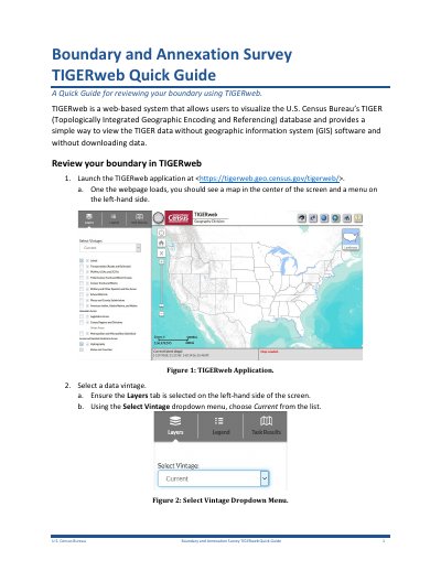
This guide explains how to use TIGERweb to visualize and review U.S. Census Bureau’s TIGER database without GIS software. Users can select data vintage, query for specific government boundaries, and zoom to view details. The guide also covers integrating TIGERweb data into ArcGIS Pro, ArcMap, and QGIS via REST services.
TIGERweb provides access to legal boundaries and other geographic layers. Users can search by GEOID or name, and toggle layers for review. The guide includes step-by-step instructions for viewing data in different GIS platforms and notes on data limitations and vintage selection.
Launch the TIGERweb application at
Launch the TIGERweb application at
Layers including American Indian, Alaska Native, and Native Hawaiian Areas, Places and County Subdivisions or States and Counties.
Enter the URL of the desired REST service from Table 1 and click Add.