
Key facts
- Manuals
- 1
- Languages
- JA
- Last added
- 2026-11-16
Featured 山背古道推進協議会 manuals
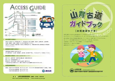
Yamashiro Kodo Trail Guidebook: Okirakuchuugesha
This is the Yamashiro Kodo Guidebook "Okirakuchuugesha", published by the Yamashiro Kodo Promotion Council, which is made up of Joyo City, Ide Town and Kizugawa City. The Yamashiro Kodo is a walking route of about 25 km crossing those three municipalities in southern Kyoto Prefecture, running roughly alongside the JR Nara Line and the Kizu River through satoyama scenery, with plum groves, tea fields, waterside spots and historic sites along the way.
The booklet explains how to reach the trail by train or car, what to wear and bring before setting out, and the trail's directional signs, including the round mountain mark used on them. It also introduces the three municipalities the route passes through and the Yamashiro Kodo Exploration Team, describing its activities and how to apply for membership. This manual is written in Japanese.
Covers: What the Yamashiro Kodo is · Preparing before setting out · Access guide · Trail signs (michishirube) · The three municipalities along the trail · Yamashiro Kodo Exploration Team
Latest 山背古道推進協議会 manuals
Yamashiro Kodo Trail Guidebook: Okirakuchuugesha
Other 10 pages · 10.4 MB · JAGuidebook to the 25 km Yamashiro Kodo walking trail in southern Kyoto, covering access, preparation, trail signs and the local exploration team.
Questions answered in 山背古道推進協議会 manuals
How long is the Yamashiro Kodo?
It is a walking route of about 25 km crossing Joyo City, Ide Town and Kizugawa City.
What should I bring when walking the trail?
Bring a lunch and a water bottle, since there are few restaurants along the route, and bring a trash bag to carry your own garbage home.