
Key facts
- Brand
- GeoMax
- Model
- Zenith10/20
- Category
- Other device
- Industry
- Industrial
- Documents
- 2
- Languages
- ZH
- Last added
- 2026-10-01
Start here
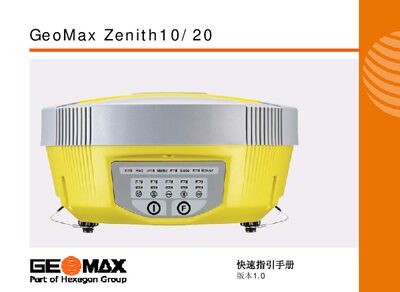
GeoMax Zenith10/20 Quick Start Guide
The Quick Start Guide introduces the GeoMax Zenith10/20 user interface, describing each button and its functions such as power on/off, mode selection, and data‑link switching. It also explains the instrument's self‑test procedure and how to verify communication with GNSS, radio and GSM modules.
Installation steps cover mounting the base, tripod, antenna and battery, as well as connecting the handheld Getac PS236 for Bluetooth communication. LED indicator meanings and battery‑low warnings are detailed to help users monitor device status during field work. This manual is written in Chinese.
GeoMax Zenith10/20 specifications
| Maximum Channels | 72 (Zenith10) or 120 (Zenith20) |
|---|---|
| Static Accuracy | 3 mm + 0.5 ppm |
| Dynamic Accuracy | 5 mm + 1 ppm |
| Weight (incl. battery) | 1.32 kg |
| Power Consumption (internal battery) | Typical 3.2 W, 270 mA |
| IP Rating | IP67 (dust‑tight, water‑proof to 1 m) |
All GeoMax Zenith10/20 documents by type
Day-to-day operation, settings and troubleshooting. Start here if the product is already set up.
The shortest path to a working setup, usually only a few pages.
Questions answered in these manuals
How many GNSS channels does the Zenith10/20 support?
The Zenith10 supports up to 72 channels, while the Zenith20 supports up to 120 channels.
What is the weight of the Zenith10/20 instrument?
The instrument, including the battery, weighs 1.32 kg (2.91 lb).
How do I turn the Zenith10/20 on?
Press and hold the power key for 1 second until the instrument starts.
How can I switch between static, base‑station and rover modes?
With the instrument powered off, hold both keys for 6 seconds until all LEDs flash, then select the desired mode with the function key and confirm by holding the power key for 1 second.